Where Should You Avoid Anchoring? Ultimate Guide to No-Go Zones
Not every quiet spot is safe for anchoring. Learn where you should avoid anchoring to protect your boat, the environment, and yourself.
Dropping anchor might seem simple: find a quiet spot, toss it in, and relax. But before you let that anchor go, hold up. Not every quiet spot is safe or legal.
Anchoring in the wrong place can damage your boat, harm marine life, or land you a hefty fine. That’s why safety, legal rules, and environmental impact should guide every anchoring decision.
In this guide, we’ll cover where you should avoid anchoring, the risks involved, and how to spot no-anchor zones like a pro. Whether you’re cruising for the first time or looking for a refresher, this will help you stay safe and out of trouble.
Where Should You Avoid Anchoring?
Knowing where not to anchor is just as important as knowing how to anchor. Certain areas can be dangerous, damaging, or illegal to anchor in, and many aren’t marked clearly.
Here are the key spots to steer clear of:
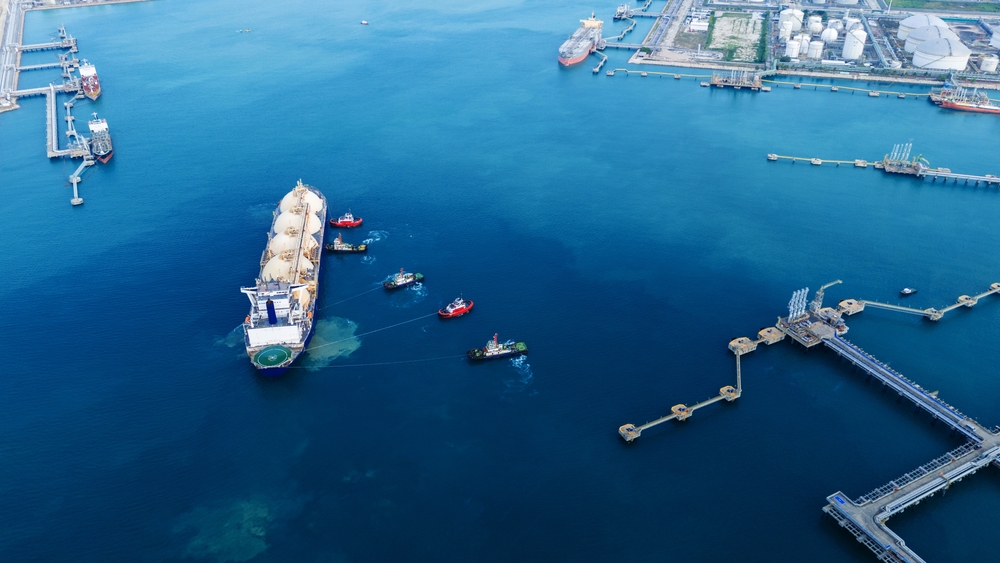
Navigation Channels and Seaport Approaches
These are active lanes for commercial vessels, ferries, and other traffic. Anchoring here is dangerous and usually illegal. You risk collisions, fines, and disrupting busy maritime routes.
Look out for: Marked channels, fairways, or port entrances on your chart.
Underwater Cables, Pipelines, and Outlets
Snagging your anchor on critical infrastructure can lead to serious damage and penalties. You could knock out power, communication, or water systems, and put yourself in danger if the anchor fouls.
How to avoid: Use up-to-date charts showing cable/pipeline zones and give them a wide berth.
Environmentally Protected Areas
This includes coral reefs, seagrass beds, marine parks, and other ecologically sensitive zones. Anchors and chains can crush corals or rip up seabeds that support fish, wildlife, and water quality.
What to do instead: Use mooring buoys when available. Many protected areas provide them to prevent anchor damage.
Heavy Traffic Areas
Busy areas with constant boat movement create wash, wake, and congestion. Anchoring here increases your risk of accidents and can be disruptive to others.
Best practice: Anchor away from ferry lanes, marina entrances, and congested day-cruise spots.
Close to Shorelines
Anchoring too close to shore, especially in tidal zones, can leave you stranded when the water level drops. It also risks swinging into rocks, docks, or shallow structures.
Check: Tidal range, swing room, and shoreline regulations before anchoring.
Beaches and Swimming Zones
Most countries prohibit anchoring near swimming areas to protect bathers. This includes designated beaches, swim platforms, and shallow areas often used by kayaks or paddleboarders.
Local rule example: In parts of the Mediterranean, you must anchor at least 50–150 meters away from shore.
Poor Holding Grounds
Not all seabeds offer good anchor grip. Mud, rock, or weed-covered bottoms can prevent your anchor from setting, leading to dangerous dragging.
Tip: Check charts for bottom type (e.g., “S” for sand, “R” for rock) and use an anchor suited to the conditions.
Deep Water Without Proper Scope
Anchoring in deep water is only safe if you have enough line out. Without the right scope (typically 6–7 times the depth), your anchor won’t hold under strain from wind or current.
Rule of thumb: For 10 feet of depth, use at least 60–70 feet of anchor rode.
Near Bridges, Dams, or Submerged Hazards
Bridges, causeways, and submerged debris often hide hazards like cables or old pilings. Anchoring too close risks snags or structural damage to your vessel.
Always check: Charts and local notices for hazard zones before anchoring.
Prohibited or Restricted Zones
Some areas may look ideal, but they’re marked as no-anchoring zones by law. These are typically enforced to protect navigation, sensitive areas, or safety infrastructure.
How to stay compliant: Review local boating regulations, notices to mariners, and anchoring apps before your trip.
Bad Weather and Strong Currents
Anchoring during storms, high winds, or strong currents increases the risk of your anchor dragging or your boat swinging uncontrollably. This can lead to collisions, grounding, or loss of your vessel.
Best practice: Check weather forecasts before anchoring, avoid exposed areas, and be prepared to weigh anchor if conditions worsen.
Beware of Country-Specific Anchoring Restrictions
Anchoring rules vary depending on where you are. Different countries (and even states or regions) have their own restrictions to protect the environment and keep navigation safe.
Safe Anchoring Alternatives
While not every spot is safe for anchoring, it doesn’t mean you're out of options. When you need to avoid sensitive zones, heavy traffic, or poor holding ground, consider these safer, smarter alternatives:
Use Mooring Buoys
Found in many marine reserves or eco-sensitive areas, mooring buoys let you tie off without damaging the seabed. They're often placed to protect coral, seagrass, or local habitats.
Look for white buoys with blue stripes or park signs, and keep in mind that some may require a permit or daily fee.
Dock at a Marina or Wharf
When in doubt (especially in bad weather or crowded areas) head for a marina. You’ll gain access to amenities and avoid swing room concerns.
Bonus: Marinas also offer fuel, freshwater, and local knowledge
Ask a Local
Harbormasters, fishermen, and experienced cruisers often know the safest places to anchor nearby, and the spots to avoid. If you're unsure, ask. This is especially useful when you are in unfamiliar waters or foreign ports
Identify No-Anchoring Zones with Charts and Apps
Many regions clearly mark no-anchoring zones on nautical charts and navigation apps. Before you drop the hook, always double-check your planned spot using these tools to avoid restricted or hazardous areas.
How to Identify No-Anchoring Zones
Not every no-anchor zone is marked with a big NO ANCHORING sign on the water. That’s why knowing how to spot restricted areas (before you drop the hook) is a key part of safe boating.
Here’s how to make sure the anchoring spot you’ve chosen is a good place to drop:
Check Nautical Charts
No matter how familiar you are with an area, you should always consult a nautical chart before anchoring. After all, conditions change, new restrictions are added, and hazards might not be visible from the surface.
Key Chart Symbols to Know
- Magenta dashed lines: These often mark underwater cable or pipeline zones. Avoid anchoring here at all costs.
- Anchor symbol with a slash: Indicates a no-anchoring zone. These can appear near ports, marine reserves, or protected infrastructure.
- Shaded zones: Show marine protected areas, swim zones, or environmentally sensitive spots like coral reefs or seagrass beds.
- Seabed symbols help assess anchor holding:
- S = Sand (ideal)
- M = Mud (acceptable with right anchor)
- R = Rock (poor holding)
- W = Weed (unreliable)
- S = Sand (ideal)
Best Practices for Using Nautical Charts
- Use updated charts: Conditions and restrictions change. Always use the latest version of official charts from sources like NOAA, Navionics, or C-MAP.
- Cross-check with local notices: Some hazards, like former military testing areas or UXO zones, may not always be obvious. Refer to Notices to Mariners or local harbor authority updates.
- Zoom in and scan carefully: Whether you're using paper or electronic charts, get close enough to spot fine details like wrecks, pipelines, or restricted zones.
- Don’t assume it’s safe just because it looks clear: Many anchoring hazards are completely hidden below the surface, and some, like submerged cables or bombing test ranges, come with serious risks.
Use a Boating App
Modern navigation apps can alert you to no-anchor zones, depth issues, and environmental protections. Some also include user-submitted updates and official local rules.
Popular options:
- Navionics
- Aqua Map
- Navily
- Garmin ActiveCaptain
Review Local Notices and Regulations
Harbormasters, coast guards, or local maritime authorities often issue “Notices to Mariners” that include new or temporary anchoring restrictions.
Watch for On-Water Markers
In some areas, you’ll find buoys, signs, or mooring fields that indicate anchoring is restricted or not allowed.
- Yellow or red buoys may mark swim zones or restricted areas
- Mooring buoys often replace anchoring in sensitive environments
Learn Local Anchoring Rules
Some countries, regions, or marine parks have their own rules, even if charts don’t show them clearly.
For example:
- Croatia has swing-circle laws near underwater cables
- Spain bans anchoring on Posidonia seagrass
- Florida has buffer zones around ports and marinas
When in doubt, ask a local or look up marine park guidelines.
Final Words: Anchoring Best Practices
Anchoring well is a key skill that keeps you, your boat, and the environment safe.
So, remember to always check your charts, local rules, and weather before you anchor. Stay clear of no-go zones, use proper techniques, and whenever possible, use mooring buoys to protect the seabed.
At Sea School, we offer practical, hands-on courses that take you from beginner basics to advanced navigation. Whether you’re new to boating or want to sharpen your skills, we’ll help you anchor with confidence and stay safe on every trip.
Remember, safe anchoring means more time enjoying your trip and less time dealing with problems. So get out there, anchor smart, and sail with confidence.
All the answers you’ll need before enrolling in any of our courses
Never anchor in navigation channels, near underwater cables or pipelines, environmentally protected areas, busy traffic lanes, swimming zones, and restricted or prohibited no-anchor zones.
Avoid anchoring during bad weather or strong winds, in shallow or rocky areas without proper swing room, near hazards like bridges or submerged debris, and when local regulations prohibit it.
No. Anchoring is restricted in many areas to protect navigation safety, the environment, and local regulations. Always check charts, local rules, and on-water markers before dropping your anchor.
Use nautical charts and apps to avoid no-anchor zones and hazards. Look for good seabed, enough space, and avoid busy or protected areas. When unsure, ask locals or use mooring buoys.